

On the second floor of a hundred year old house near Vilas Park in Madison, Wisconsin, is a guest bedroom known as the Map Room.
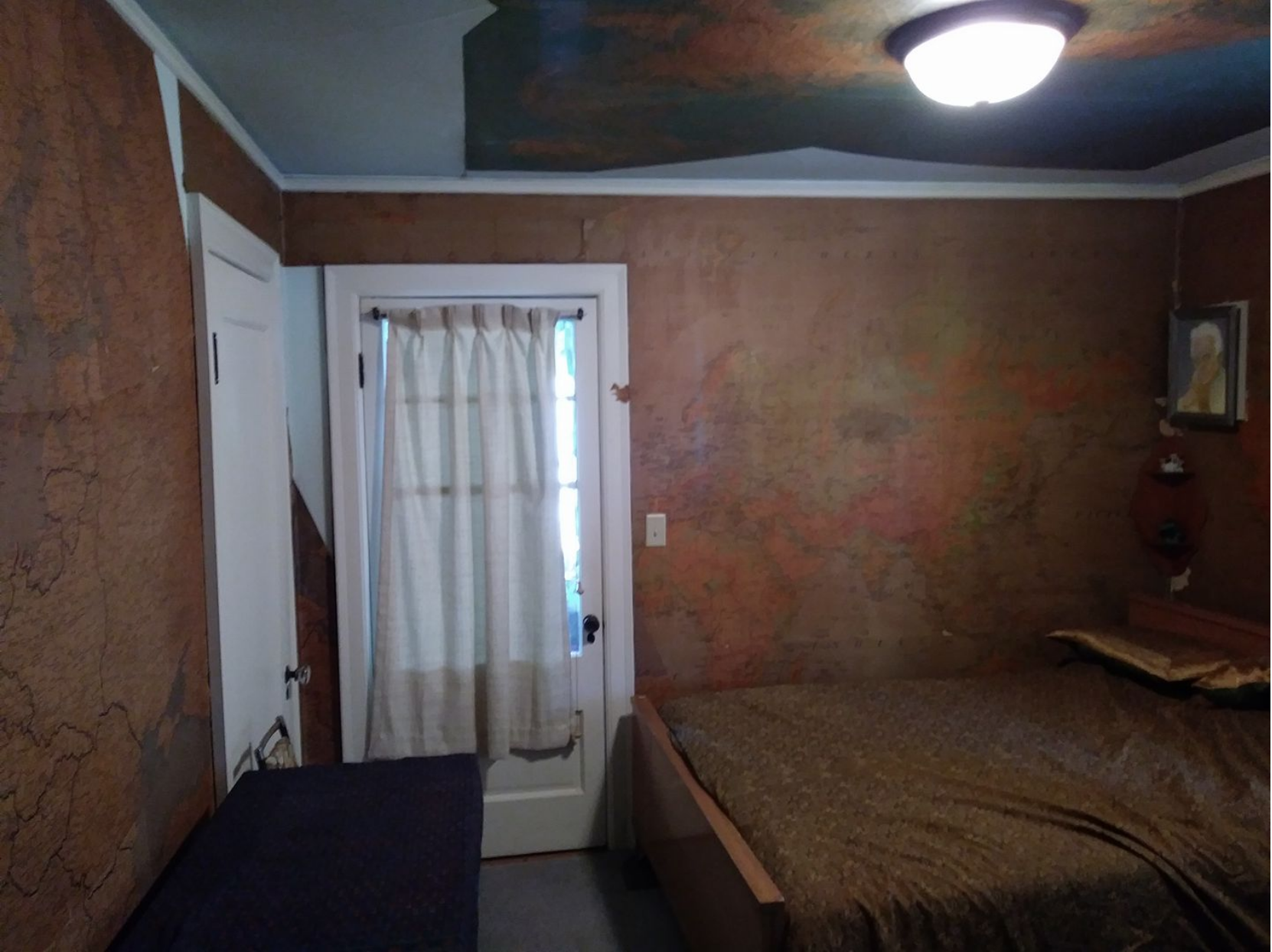
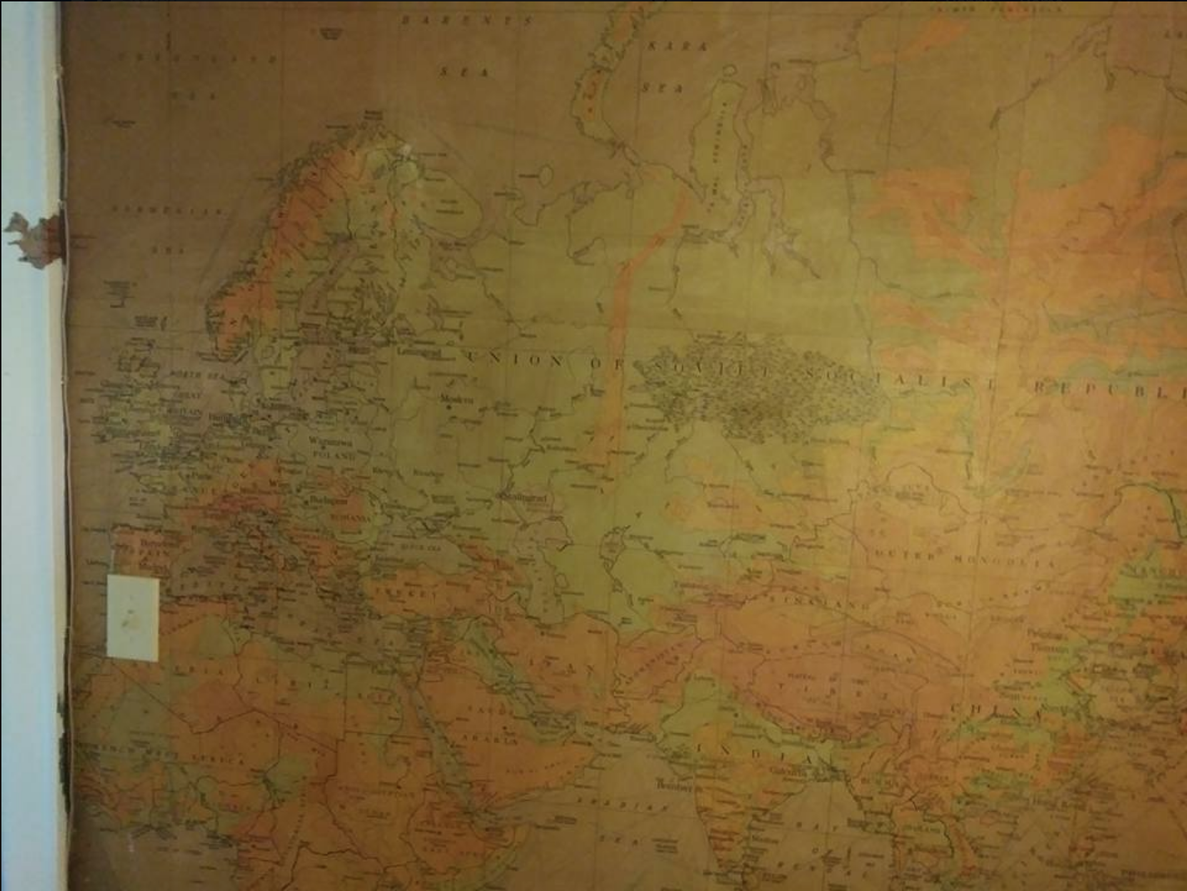
Three of its four walls have been wall papered by huge maps of the world.

The ceiling too is a map of the world as seen from above the “top” of the globe.

The light fixture cleverly doubles as the North Pole ice cap.

Another whimsical touch is this outline of Iceland wrapped around a door frame.
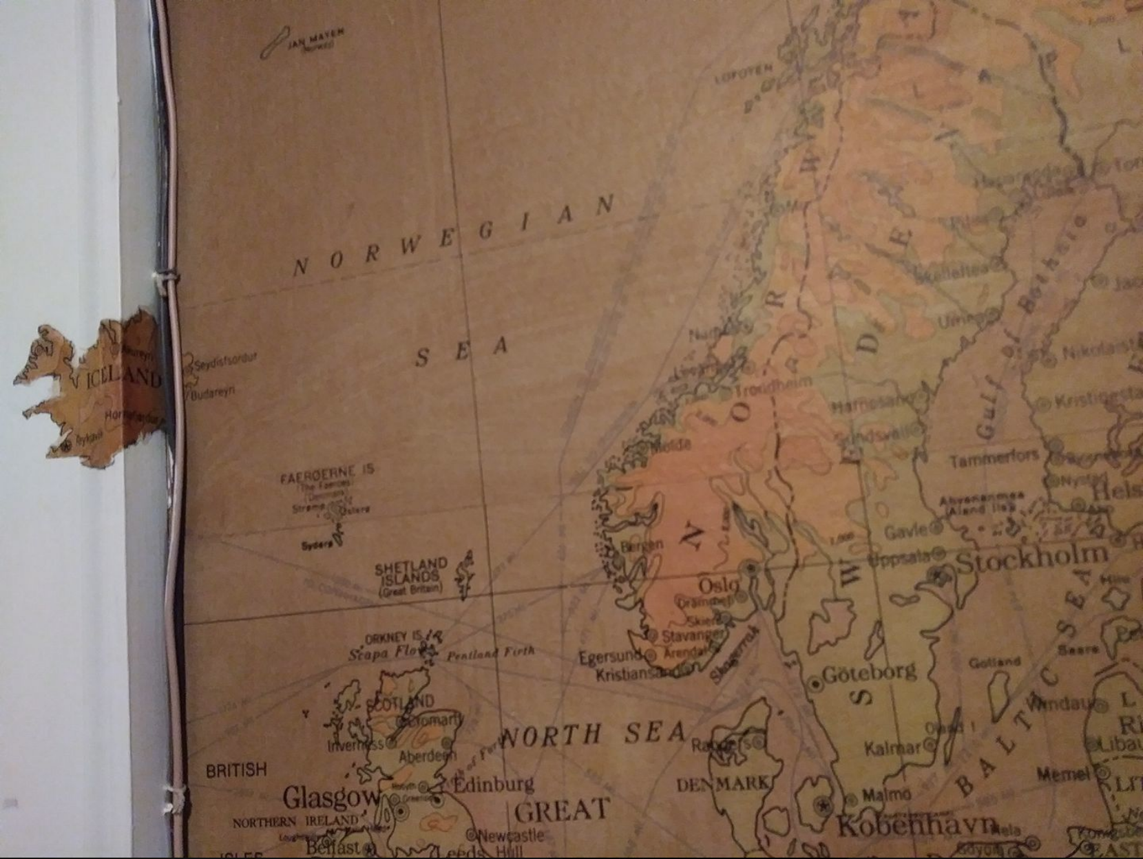
The map appears to be from the 1930s. Germany’s borders here are from between the two World Wars.

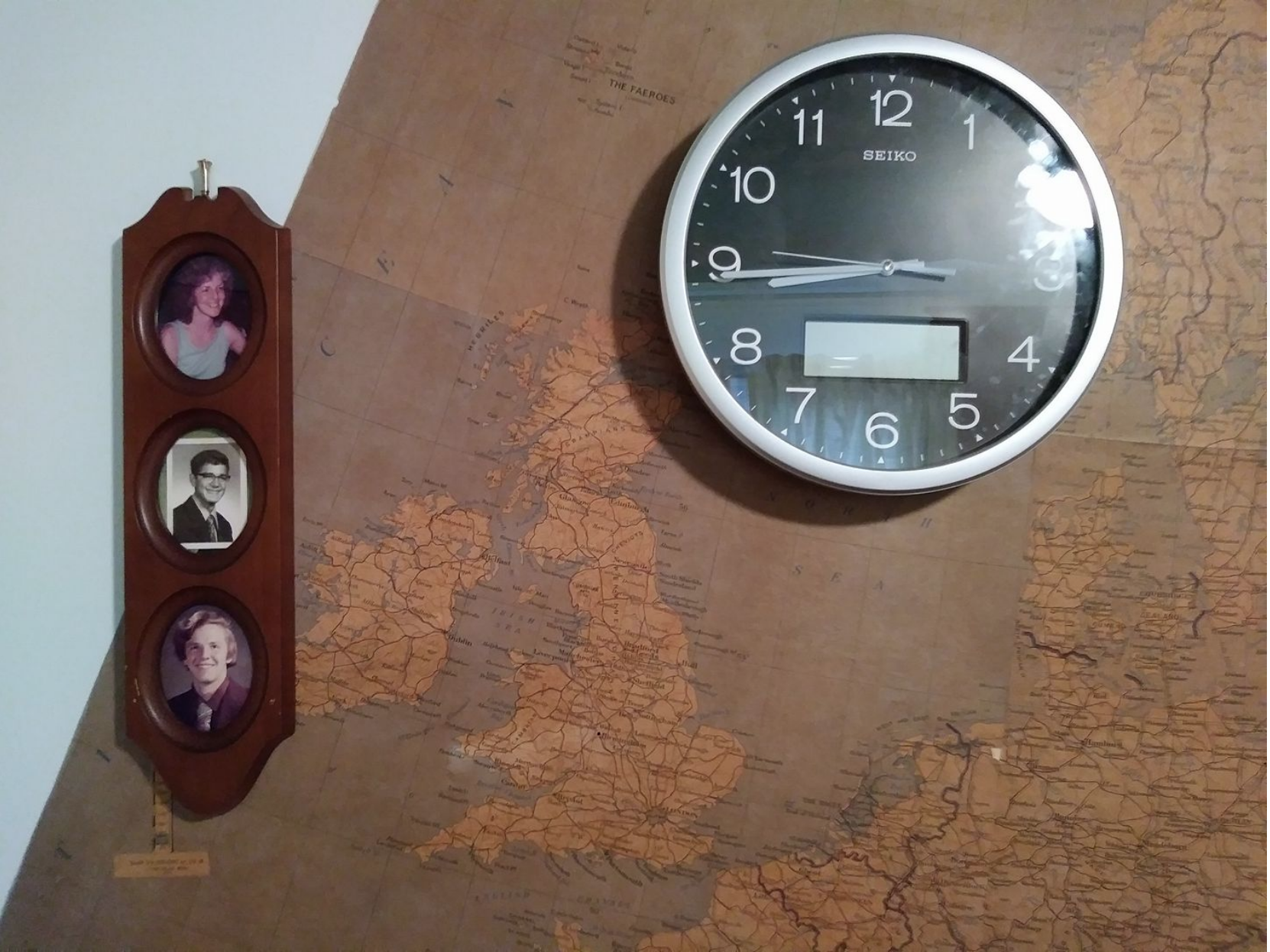
The family that refers to this bedroom as the “Map Room” has lived here since the early 1960s. These pictures below to the left are from the now adult children when they were still teenagers (one of the three is now a grandparent). That’s my husband Ed Elder at the bottom, when his hair was still red and before he grew his mustache.

Churchill War Room recreated for “Darkest Hour”
The Elders were told the previous owner of the home was a general. General Immel. Which explains a lot. These maps are clearly the kind of oversized maps used during World War 2. You can see maps just like them used by Winston Churchill in the War Rooms recreated in the movie “Darkest Hour” currently playing in theaters.
Very few references to a General Immel could be found via Internet searches. But we did finally discover a General Ralph Immel who lived in Madison, Wisconsin. He appears to have been involved with the Wisconsin National Guard. One reference named an Adjutant General Ralph Immel. Another a Brigadier General Ralph Immel.
Perhaps the Map Room was installed as General Immel’s personal “War Room” during World War 2. I don’t know whether the general was crucially involved in the war effort or merely procured and installed these maps for private study while far from the action in Wisconsin National Guard exile. I assume the latter.
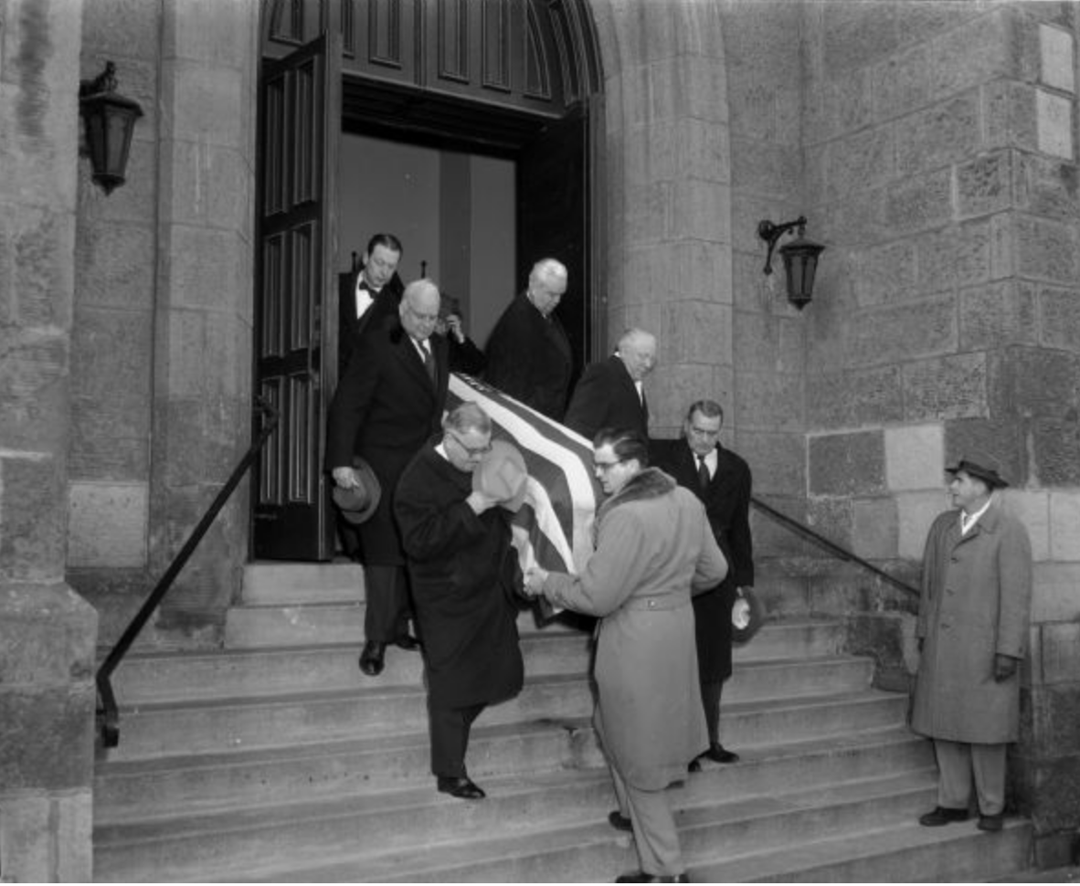
 The most exciting find of our internet sleuthing was an article (featuring the picture above) of famed Wisconsin Senator Robert LaFollette’s funeral in 1953, which lists now Major General Ralph Immel as one of the six pallbearers. This detail of the photo to the right shows the only image of the general we found.
There’s another detail about the maps that always intrigued me. The small winter vacation town of Kitzbühel is prominently listed in Austria, between the much larger cities of Innsbruck and Salzburg. In italics, no less. Kitzbühel happens to be where my family would go skiing and hiking for decades, driving down from Berlin. (I have just recently posted about Kitzbühel’s “buried” Nazi past here and its musically inclined cows here.) But it is a small town, no larger than so many unmarked others. Why is it so prominently placed on this map?
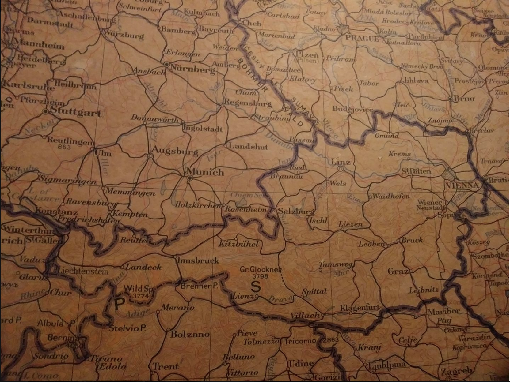
I used to believe it was an indication that Kitzbühel might have been particularly famous for its winter sports in the 1930s. But now I think World War 2 history provides a better clue. I learned this year that the Grand Hotel in Kitzbühel was a major Nazi command center during the war. I now notice that certain towns that may have had strategic WW2 significance are listed on the map while similarly or larger sized cities are not. For example, in Southwestern Germany Freiberg is missing from the map, but neighboring Pforzheim (near Stuttgart) is listed. Nowadays Freiberg is considered a much more significant town than Pforzheim. But Freiberg was mostly spared by allied bombing during the war, while Pforzheim was a prime target because it hosted major industries supplying Nazi armaments. So strategic wartime importance may have influenced what towns are listed on these maps, and which aren’t. Towns in italics like Kitzbühel may have been otherwise unremarkable, small towns made especially relevant by the Nazis. Nonetheless, Hitler’s vacation destination in the German Alps, Berchtesgaden, is not on the map.
By the way, that portrait in the corner of the wall in the final picture of the Map Room below looks a little like what we know of General Immel’s visage. But it’s not. The daughter of the house painted that likeness of a Swedish poet in the 1970s.

UPDATE: In August, 2018, the family home was sold. The new owners eventually gave the house a top to down renovation. The Map Room of Madison, Wisconsin is no more.

Danny, you are amazing. What a wealth of information is here. Next visit we’ll show you the house abstract? of former owners to add to the history. Also there is more information about General Immel in Wis. Historical building.
LikeLiked by 1 person