An annotated bird’s eye view of NYC’s best borough.
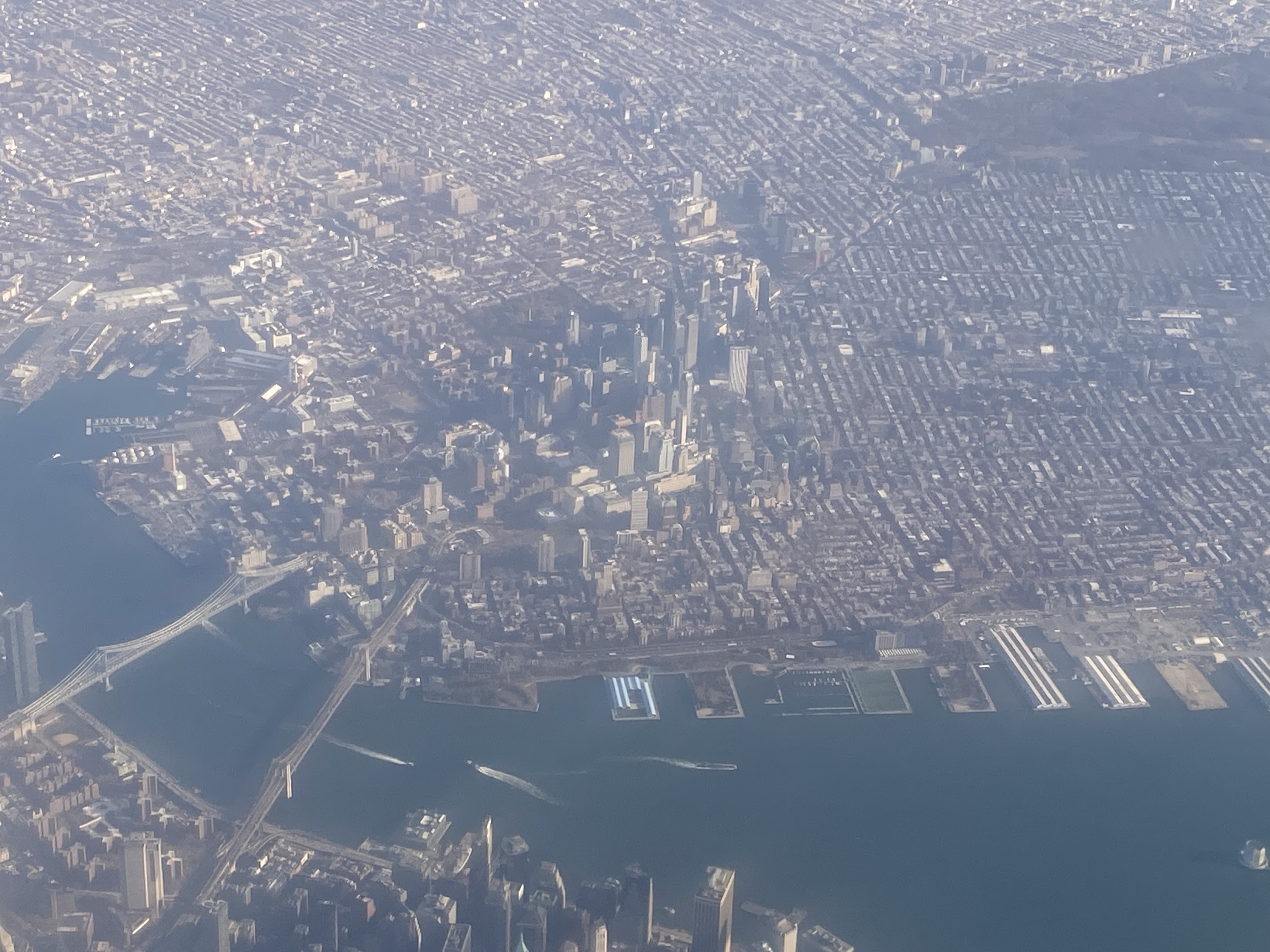
After we took off from New York City’s La Guardia airport on our Thanksgiving trip, the plane flew over the city and I got this great view of Brooklyn, my home borough. I was facing southeast when I took this picture.
At the left bottom of the photo you can see the Manhattan and Brooklyn Bridges side by side leading from Manhattan into Brooklyn’s DUMBO neighborhood, with Brooklyn Heights to the right of Brooklyn Bridge.
In the center rise the skyscrapers of Downtown Brooklyn, with Fort Greene and Clinton Hill spreading out behind in the left upper corner of the photo.
Circling around clockwise, at top center lies Prospect Heights, and in the top right corner you find Prospect Park.
Sloping just below Prospect Park lies Park Slope (my neighborhood) – you can actually see it slightly sloping down from the park, and the diagonal swath Flatbush Avenue cuts from Downtown Brooklyn towards Park Slope, dividing Prospect Heights from Park Slope.
Center right just below Park Slope lie Boerum Heights and Gowanus, and below that, right of Brooklyn Heights along the piers of the East River, you find Carroll Gardens.
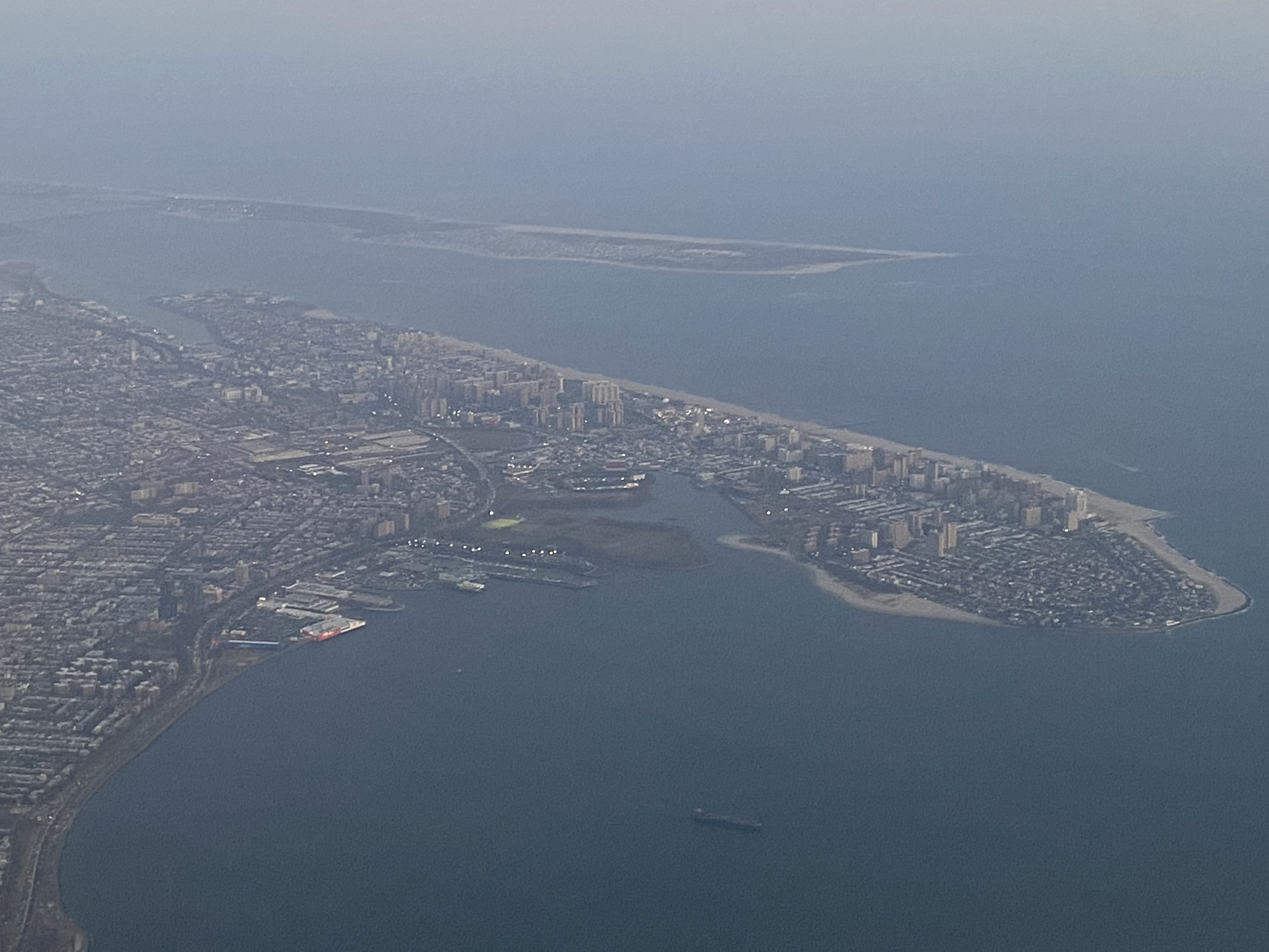
Returning to the city after Thanksgiving I got a few more views of Brooklyn.
Here is Coney Island, with the Breezy Point tip of Far Rockaway out behind it in the water. The bulging part of Coney Island at right is called Seagate.
Up front lies Prospect Park, with Prospect Lefferts Gardens behind it, and East Flatbush and Canarsie spreading out further behind.

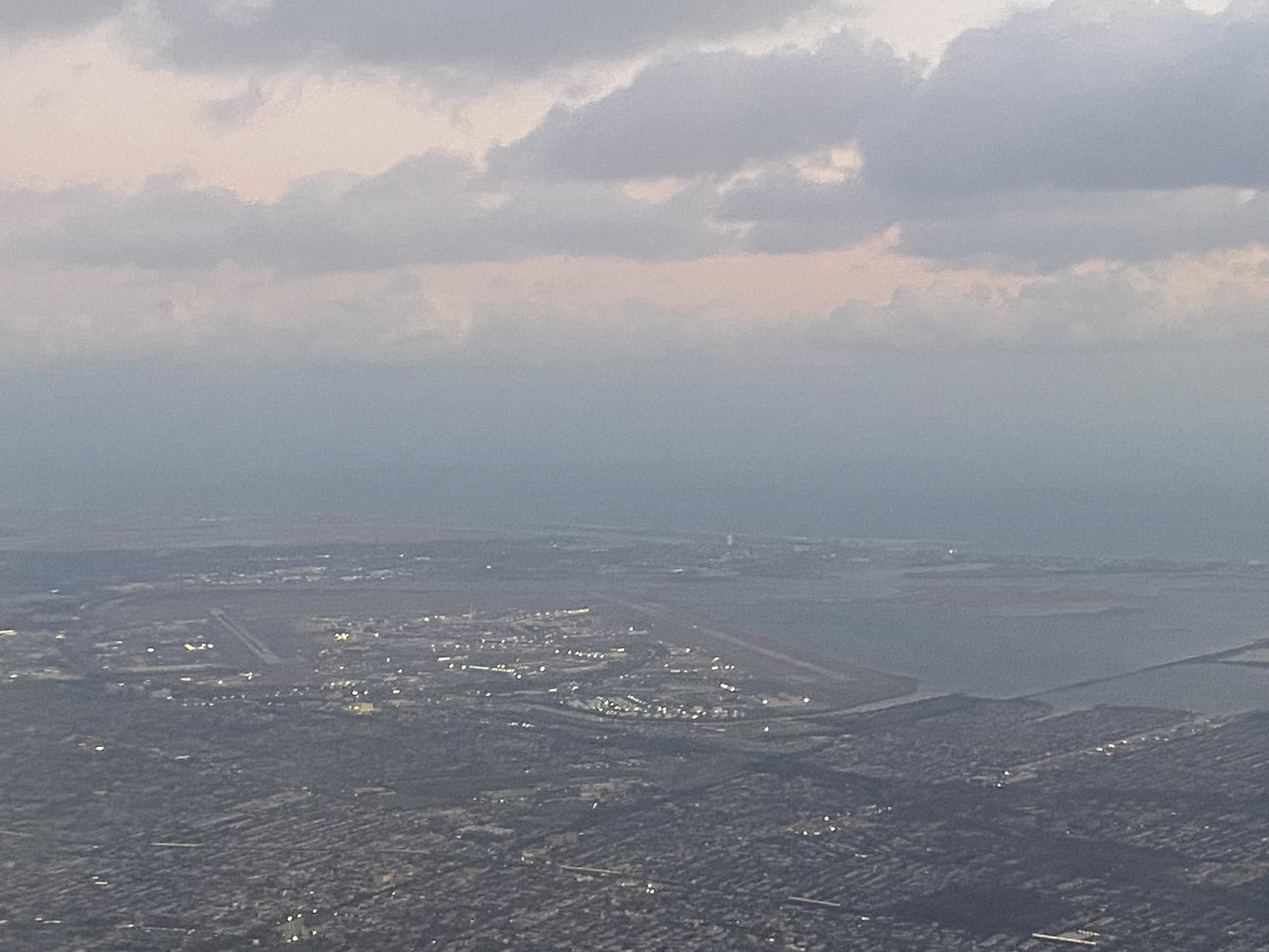
JFK airport sits in the center of this picture, but technically that is Queens, not Brooklyn.